I had an Irish speaking friend years ago who laughed at my pronunciation of Coumshingaun Lough. He was right of course because I butchered it. Thankfully he told me how to pronounce it and I have since forgotten that information, like most good information it leaves my head. After a quick look on the trusty Internet, I have found how to pronounce it, at least by the locals which is good enough for me (Academics argue over the pronunciation). I refer to this article where it says the pronunciation is Com Shin-aun so basically drop the g.
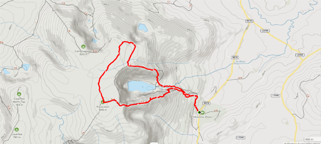
Coumshingaun Lough is a beautiful walk which can cater for a range of different abilities. Here are the main routes
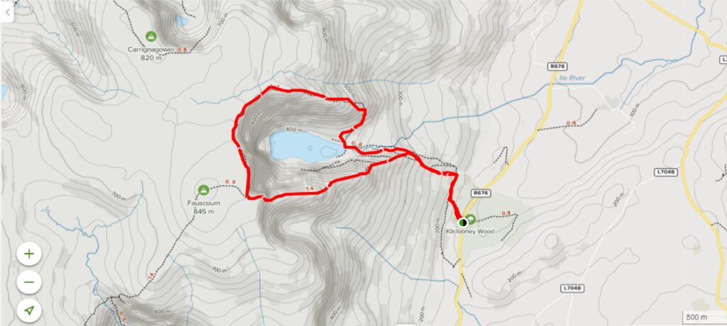
Coumshingaun Loop Walk
- Length: 7.2 Km
- elevation gain 627 m
- Level: Strenuous
- Time: 3 to 4 hours
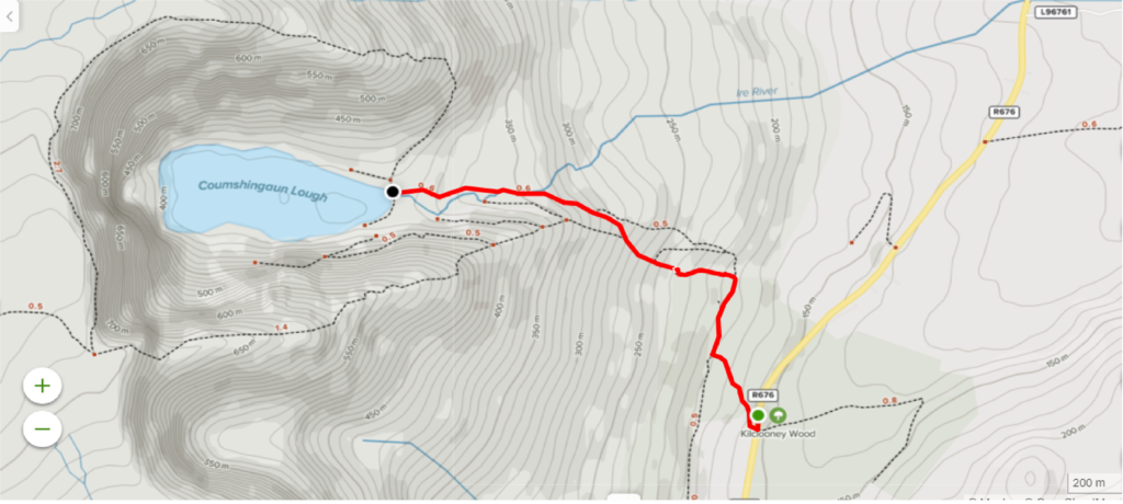
Lake Walk
- Length: 3.6 Km (Up and Back)
- Elevation gain: 180m
- Level: Moderate
- Time: 2 hours
Coumshingaun Lough Walk
Both walks start at Kilclooney Woods or there is another car park just down the road. It can get very busy on the weekends so get up early to secure a parking place. Please park responsibly, walkers get a bad reputation for parking inconsiderately.
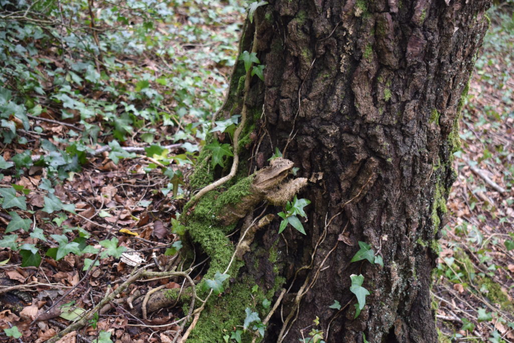
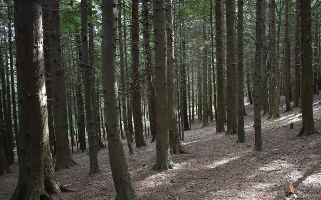
Kilclooney is mainly a coniferous woodland of Sitka spruce, native Scots pine, Norway spruce, European larch and Western hemlock with small pockets of broadleaves dispersed throughout. Foxes, badgers and fallow deer are regularly spotted, although elusive. The agile red squirrel may be seen from time to time foraging or darting up the trunks of trees and running along the branches in the canopy above. Try and spot the disguised radio tower on the left when you are walking up the forest trail. They have done a great job to make the tower look like a tree and it works pretty well.
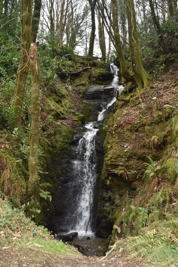
The trail is pretty obvious from the car park just follow uphill and you will eventually get to the start of the mountain trail. This is a well-used path so its hard to miss. Keep following up and you will start to get some great views looking South and East of the patchwork of fields in Waterford. you can see the Saltee Islands on a clear day.
The Big Ridge
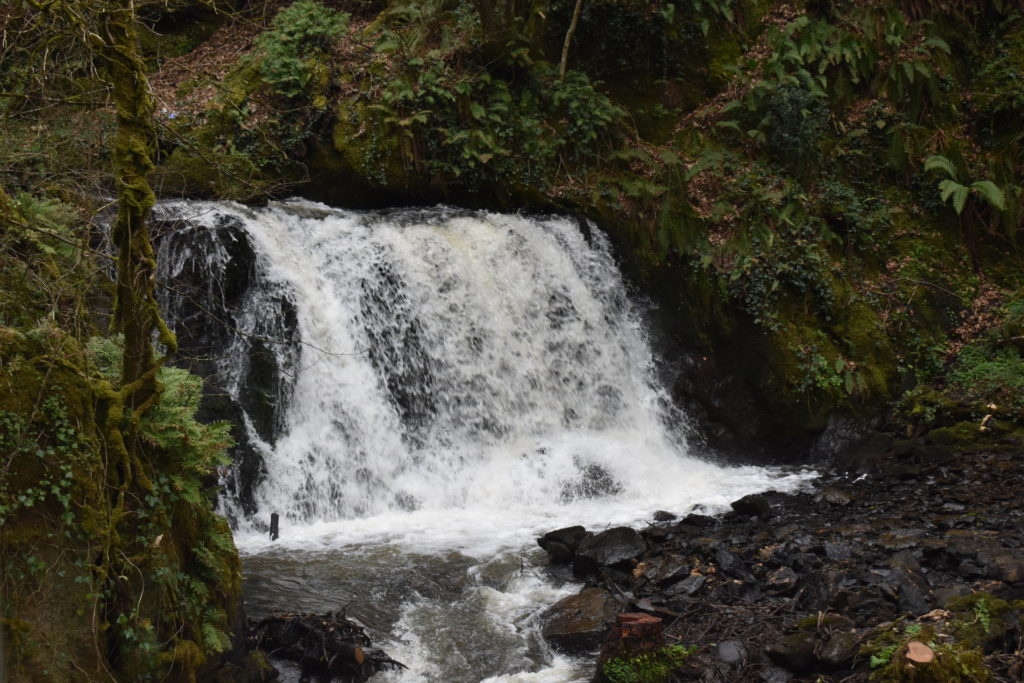
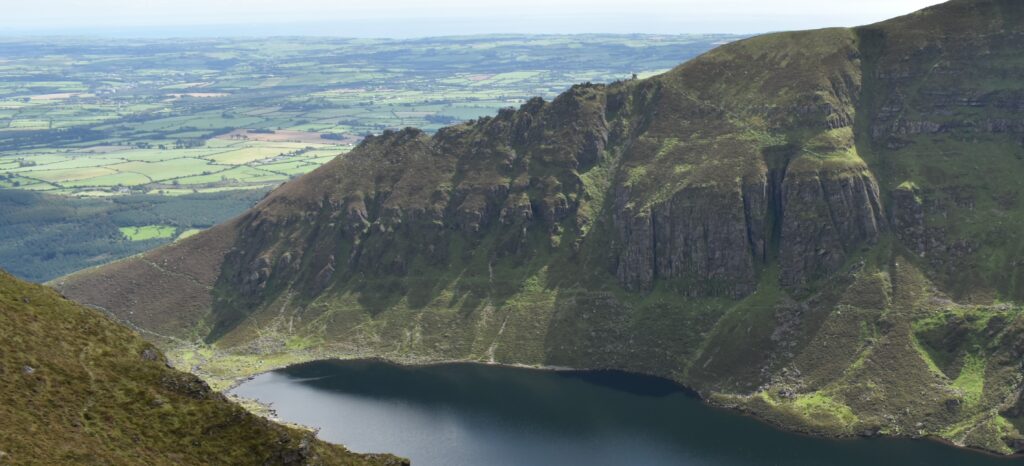
You can see the big ridge line now that will take you up and around the lake. It is an impressive ridge and is a pleasure to walk. It has a mix of rocky ground with some minor scrambling and some boggy sections too. If you decide to take the loop route it gains a lot of height quickly so breaks will be needed. You will be treated to views of one of Ireland’s best Corries, it is impressive and the scale of it is mighty. It is recommended to walk the loop in a clockwise direction because there is a few sections of scrambling climbing which is safer to climb up than climb down but the route can be done both ways.
Shorter Walk up to the Lake
If you opt for the shorter walk up to the lake you will not be disappointed. It is a fantastic walk with views Inside the corrie just as impressive as on top. This is a great walk if you have kids and don’t want to commit to the Bigger loop walk. The lake is packed full of brown trout and you can see fish jumping here regularly. Coumshingaun lake is 54 Metres Deep at its deepest point and can be as low as 6 degrees, So if your going in for a dip be mindful of that.
There used to be a hermit living in the Lake up till 1959 by the name of Jim Fitzgerald. Known as ‘Lackendara’. He Lived halfway up the Comeragh Mountains for over forty years. His home was a cave of sorts, with a roof comprised of bits of driftwood, stones and soil, and an entrance concealed by strips of hanging grain bags. A veteran of WW1, where he was said to have suffered shell-shock. He spent the remainder of his life in isolation in this rugged and unforgiving terrain in the foothills of the Comeraghs.
I am fascinated with this story. It would have taken a strong-willed human to live up in the mountains like this. If you would like to see the rock where he lived just click here. If you would like more information on this story there was a video made of him a couple of years back. I will link it here it’s worth a watch.
Crotty’s Rock
Crotty’s Rock is well worth a visit and is only a short walk away from the top of the loop walk. It can get very wet so be prepared for that. William Crotty was a highwayman who had a reputation for stealing from the rich and giving to the local people. He was betrayed by his long time friend and captured, he was hanged and quartered. His legend still lives on today and Crotty’s rock is a popular spot for walkers and climbers.
Final Thoughts
The Coumshingaun Lough is well worth a look for a Beginner or experienced walker. A lovely mix of terrain and the views are spectacular. There is plenty of history associated with this part of Waterford and is worth some further research if that’s your thing.
If you’re taking to the hills please remember to take some extra layers and food with you. The weather changes very quickly in the mountains and things can go wrong quickly. If you need more information on what to wear and bring with you to have a look at this.
if you would like to see any of my other posts please click Here